
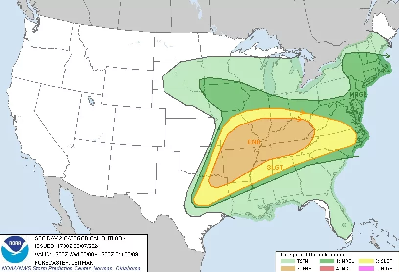
Here is the latest map from the National Weather Service Storm Prediction Center in Norman, Oklahoma.
The entire Ken-Tenn area remains in a Level 3, or Enhanced Risk Zone, for the potential of severe thunderstorms on Wednesday.
Current forecasts indicate the possible storms during the evening on Wednesday, with the primary threats now listed as large hail, damaging winds and the potential for tornadoes.
(map- National Weather Service)