
Today is a Weather Alert Day for the Ken-Tenn area.
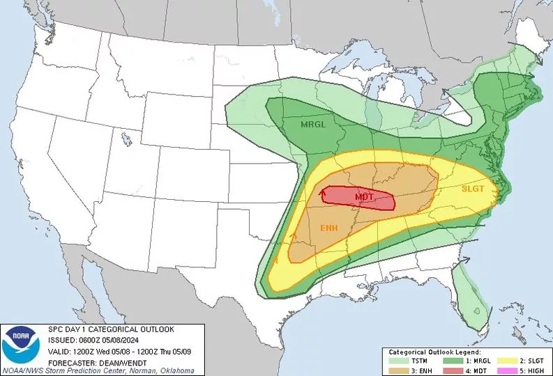
The National Weather Service has now placed the local area in a Level 4, or Moderate Risk Zone, for the possibility of severe thunderstorms, which includes Lake, Obion and Weakley County and all of Western Kentucky.
Here is the latest statement from the National Weather Service Storm Information Center in Norman, Oklahoma.
.THERE IS A MODERATE RISK OF SEVERE THUNDERSTORMS FOR
SOUTH-CENTRAL/SOUTHEAST MISSOURI…SOUTHERN ILLINOIS…NORTHWEST INTO MIDDLE TENNESSEE…WESTERN KENTUCKY…
…SUMMARY…
Numerous severe thunderstorms appear likely Wednesday from parts of the mid Mississippi, Ohio, and Tennessee Valleys into the southern Plains. All severe hazards, including tornadoes, very large to giant hail, and potentially significant damaging winds are possible. Some of the tornadoes may be strong.