
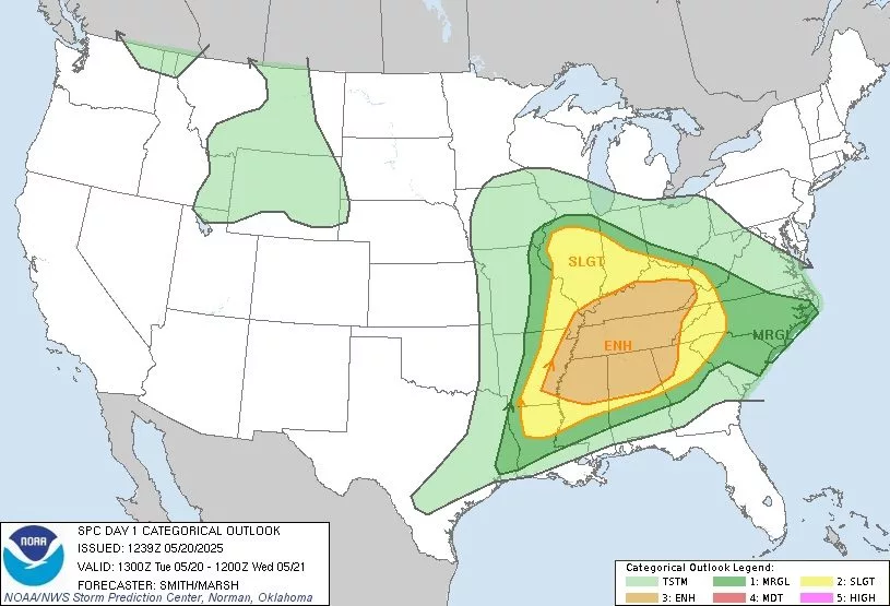
The Storm Prediction Center in Norman, Oklahoma has placed the entire Ken-Tenn area in a Level-3 or Enhanced Zone for the possibility of severe thunderstorms for today.
Forecasters say moderate to potentially strong instability could provide supercell winds across the region and creating all severe weather hazards including large hail, heavy rainfall and tornadoes.
The Weather Service said squall lines could bring strong to damaging winds in the evening hours.
Counties included in the Level 3 Zone are Lake, Obion, Weakley, Dyer and Gibson, along with Fulton, Hickman, Graves, Calloway and McCracken County in Western Kentucky.
(map: National Weather Service)