
The National Weather Service has issued a weather alert day for Wednesday, which includes the Ken-Tenn area.
Forecasters say an approaching cold front will produce a squall line of storms, which could create strong, damaging winds and hail.
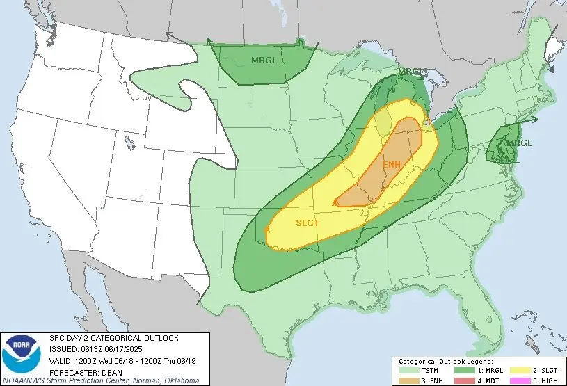
A radar timeline for these possible storms appears to be after 6:00 on Wednesday night.
Currently, the entire Ken-Tenn area has been placed in a Level 2 zone for the possible storms, with areas just north being placed in a Level 3 out of five zone.
The Weather Service says watches and warnings could be issued during the day on Wednesday.
(map: National Weather Service)