

The National Weather Service in Memphis says there is a chance of severe thunderstorms and heavy rainfall in the Ken-Tenn area later today.
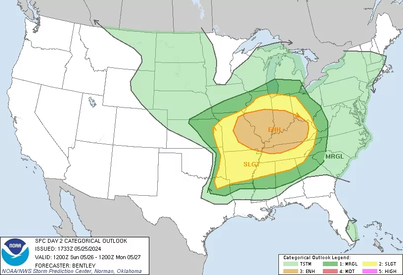
Weather Service officials have placed the area in a Level 2, or slight risk zone, for the possibility of strong to severe storms.
The timeline of the possible severe weather has been placed between 10:00 and 2:00 tonight.
The primary threats include damaging winds and possible tornadoes, with large hail and heavy rain fall during the period.
Counties in the Level 2 zone include Lake, Obion, Weakley, Dyer, Gibson and Henry, along with Fulton, Hickman, Graves and Calloway County in Western Kentucky.