
The National Weather Service in Memphis has released a “Special Weather Statement” for West Tennessee.
Forecasters say there is the possibility of a light wintry mix this afternoon through late evening.
Currently little or no accumulations of freezing rain or sleet are expected in Northwest Tennessee.
Should temperatures drop below freezing later today, the Weather Service says light accumulations of snow could occur.
Currently forecasts for Obion, Lake and Weakley County call for cloudy skies this afternoon, with a 20-percent chance of snow showers before 7:00.
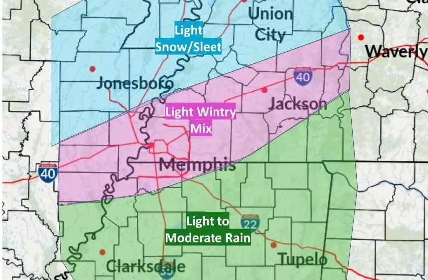
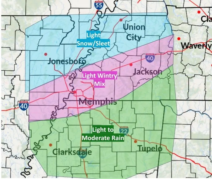
A Memphis National Weather Service prediction map has been posted.