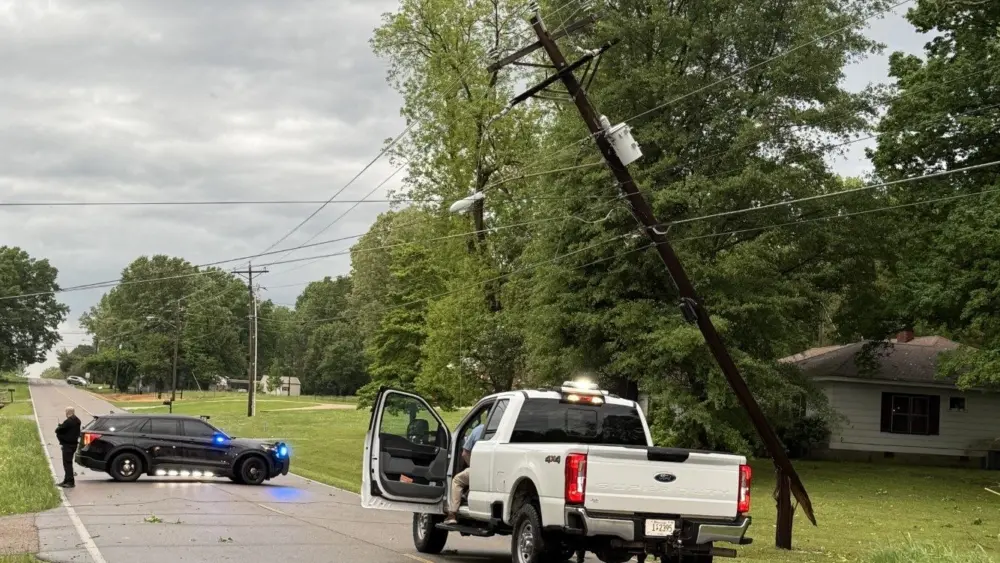
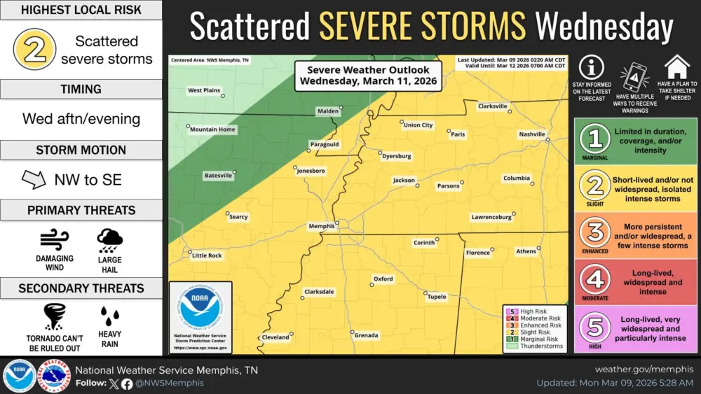

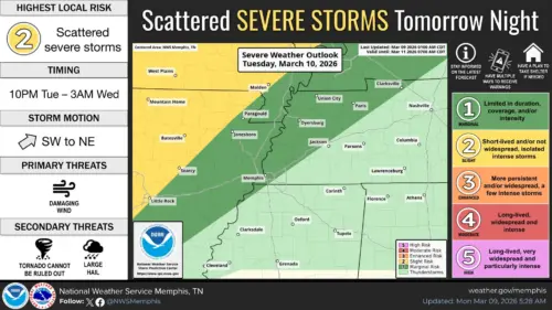
The Ken-Tenn area could see strong to severe thunderstorms both today and tomorrow.
The local area is in a Level 1, or Marginal Risk, to today, and a Level 2, or Slight Risk, for Wednesday.
Paducah National Weather Service Lead Forecaster David Humphrey talked with Thunderbolt News about the approaching storm front.(AUDIO)
While damaging winds and hail are currently the main threats associated with the front, Humphreys said the chance of tornadoes cannot be eliminated.(AUDIO)
(HUMPHREYS2) NEWS388N
Forecasts also show daytime temperatures on Wednesday fall from the mid-70’s to the upper-30’s on Wednesday night.
(maps: National Weather Service)