
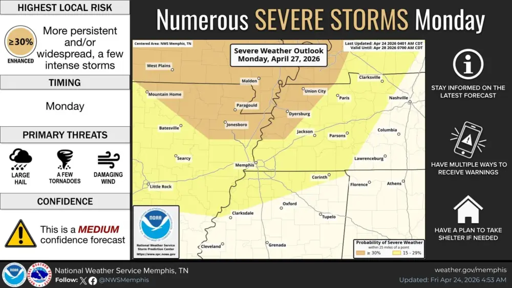
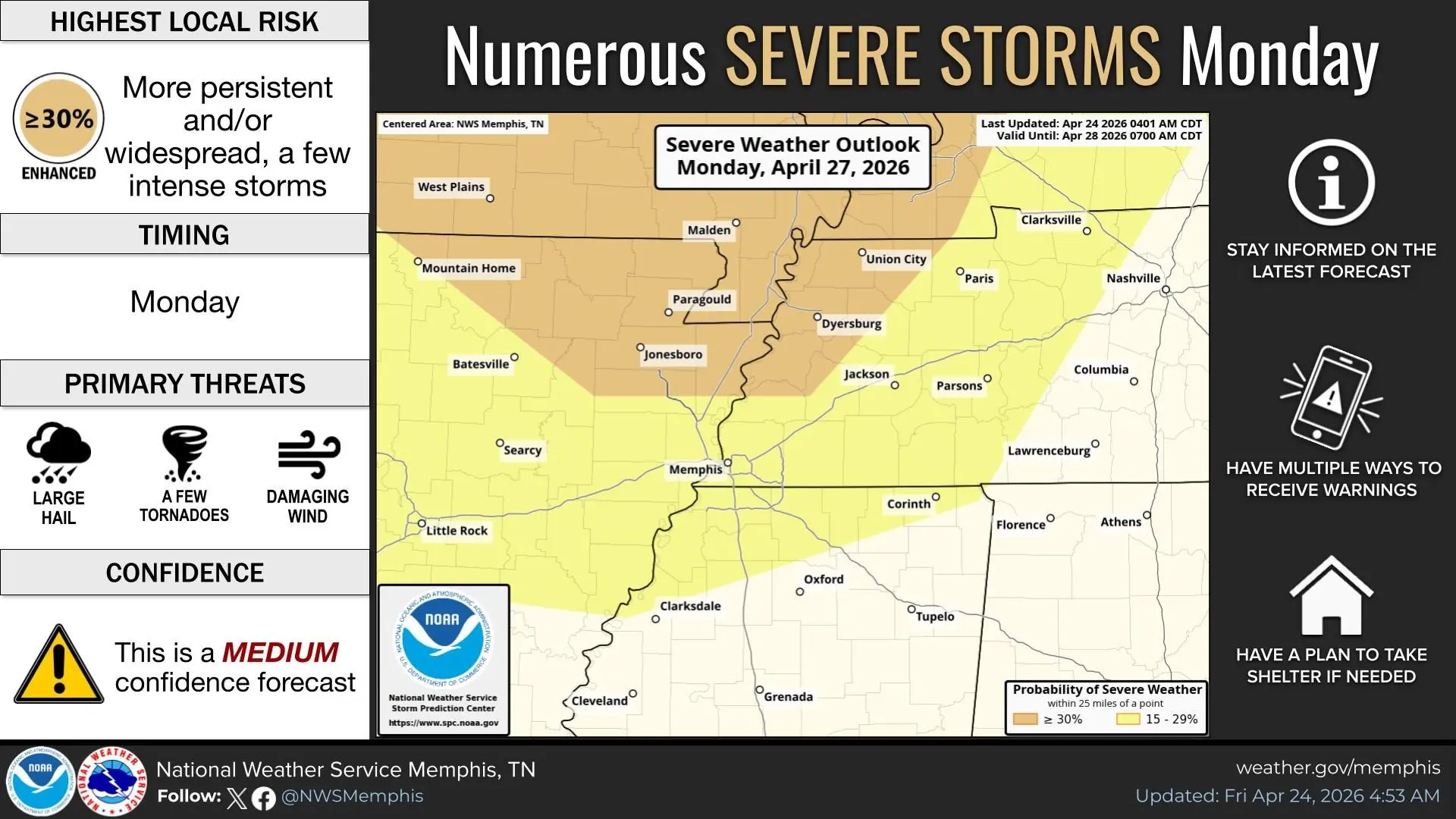
Residents of the Ken-Tenn area are being advised to stay tuned to local forecasts pertaining to the possibility of severe weather on Monday.
For the past several days, forecasters have been watching the set up for potential storms on Monday, which have so far not changed.
The National Weather Service in Memphis has already placed Lake, Obion, Weakley, Dyer and Gibson County, along with Fulton, Hickman, Carlisle, Graves and Calloway County in a Level 3, or Enhanced Risk category, for severe thunderstorms.
At this time, forecasters say the primary threat will be strong damaging winds, large hail and a few tornadoes.
Forecasters also say this is a “Medium” confidence forecast for three days out.
The National Weather Service is urging residents in the local area to stay informed this weekend to the latest forecasts pertaining to Monday’s weather situation.